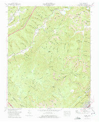
1973 Map of Ivydell
USGS Topo · Published 1975About this map
Pine Mountain and Walnut Mountain dominate this corner of Campbell County, where the steep topography of the Cumberland Plateau is marked by extensive extractive industry. Numerous Strip mine and Strip mines operations are cut into the ridges of Steve Ridge and Rough Ridge, showing the heavy footprint of coal mining in the early 1970s. The landscape is a network of remote hollows and high gaps, such as Big Hurricane Gap and Cave Gap, which provided natural passages through the daunting terrain.
Find a feature on this map
76 named features on this map. Tap any name to fly to it.
Don’t see what you’re looking for? This feature index may not catch every label — zoom into the map to look around manually.
Map Details
Editions of this 1973 Ivydell Map
This is the sole edition of this map. No revisions or reprints were ever made.
Other maps of this area

1890 · Williamsburg
USGS Topo · 1:125,000

1893 · Briceville
USGS Topo · 1:125,000

1894 · Williamsburg
USGS Topo · 1:125,000

1895 · Briceville
USGS Topo · 1:125,000

1896 · Briceville
USGS Topo · 1:125,000

1936 · Ivydell
USGS Topo · 1:24,000

1936 · Block
USGS Topo · 1:24,000

1936 · Jacksboro
USGS Topo · 1:24,000

1936 · Pioneer
USGS Topo · 1:24,000

1936 · La Follette
USGS Topo · 1:48,000