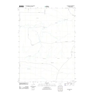
2012 Map of J H D Ranch
USGS Topo · Published 2012About this map
Horse Cr and Trail Cr carve through this section of Laramie County, defining a landscape dominated by the extensive operations of the J H D Ranch. The distribution of named outposts like Upper J H D Camp, Beaver Camp, and Luey Huey Camp illustrates a sophisticated ranching infrastructure designed for managing livestock across varied terrain. The presence of specialized sites such as Coyote Mill Camp and Pasture Mill Camp suggests a focus on localized water or processing hubs, supported by the J H D Supply Ditch and landmarks like the Tinker Windmill. This network of camps and local roads, including Indian Hill Rd and Trail Creek Rd, provides a clear view of the working geography of a modern Wyoming ranching territory at the start of the 2010s.
Find a feature on this map
26 named features on this map. Tap any name to fly to it.
Don’t see what you’re looking for? This feature index may not catch every label — zoom into the map to look around manually.
Map Details
Editions of this 2012 J H D Ranch Map
This is the sole edition of this map. No revisions or reprints were ever made.
Other maps of this area

1911 · Cheyenne
USGS Topo · 1:125,000

1914 · Cheyenne
USGS Topo · 1:125,000

1954 · Cheyenne
USGS Topo · 1:250,000

1958 · Cheyenne
USGS Topo · 1:250,000

1962 · P O Ranch
USGS Topo · 1:24,000

1962 · Moffett Ranch
USGS Topo · 1:24,000

1962 · Lewis Ranch
USGS Topo · 1:24,000

1963 · Little Indian Draw
USGS Topo · 1:24,000

1963 · Pole Creek Ranch SE
USGS Topo · 1:24,000
1963 · Pole Creek Ranch
USGS Topo · 1:24,000