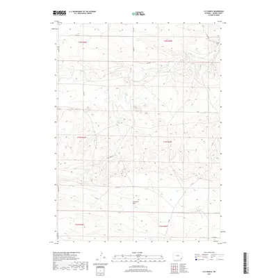
2017 Map of J H D Ranch
USGS Topo · Published 2017About this map
J H D Ranch serves as the namesake and primary hub for this Laramie County map, situated in an area of Wyoming characterized by ranching operations and water management. The landscape is defined by the winding course of Horse Cr and Trail Cr, which are supported by local infrastructure like the J H D Supply Ditch. The presence of Missile Rd suggests the modern integration of military or industrial utility into the traditional rural grid, which is otherwise composed of county routes such as Trail Creek Rd and Indian Hill Rd. Wide draws like Chivington Draw provide important drainage across the high plains, illustrating the topographical challenges of maintaining agriculture and land access in the eastern part of the state.
Find a feature on this map
22 named features on this map. Tap any name to fly to it.
Don’t see what you’re looking for? This feature index may not catch every label — zoom into the map to look around manually.
Map Details
Editions of this 2017 J H D Ranch Map
This is the sole edition of this map. No revisions or reprints were ever made.
Other maps of this area

1911 · Cheyenne
USGS Topo · 1:125,000

1914 · Cheyenne
USGS Topo · 1:125,000

1954 · Cheyenne
USGS Topo · 1:250,000

1958 · Cheyenne
USGS Topo · 1:250,000

1962 · P O Ranch
USGS Topo · 1:24,000

1962 · Moffett Ranch
USGS Topo · 1:24,000

1962 · Lewis Ranch
USGS Topo · 1:24,000

1963 · Little Indian Draw
USGS Topo · 1:24,000

1963 · Pole Creek Ranch SE
USGS Topo · 1:24,000
1963 · Pole Creek Ranch
USGS Topo · 1:24,000