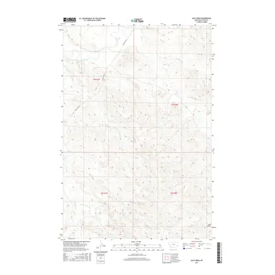
2017 Map of Jack Creek
USGS Topo · Published 2017About this map
The Tongue River meanders through the northwest corner of this Custer County landscape, followed closely by the winding path of Tongue River Rd. This drainage-rich area is defined by an intricate network of waterways including Jack Creek, Sand Cr, and Ash Cr, which carve through the high plains and break the terrain into a series of coulees and ridges. In the southeast, the prominent elevation of Red Butte stands as a distinct landmark overlooking the convergence of local seasonal streams.
Find a feature on this map
18 named features on this map. Tap any name to fly to it.
Don’t see what you’re looking for? This feature index may not catch every label — zoom into the map to look around manually.
Map Details
Editions of this 2017 Jack Creek Map
This is the sole edition of this map. No revisions or reprints were ever made.
Other maps of this area

1953 · Miles City
USGS Topo · 1:250,000

1954 · Ekalaka
USGS Topo · 1:250,000

1956 · Ekalaka
USGS Topo · 1:250,000

1957 · Miles City
USGS Topo · 1:250,000

1958 · Miles City
USGS Topo · 1:250,000

1958 · Ekalaka
USGS Topo · 1:250,000

1965 · Ekalaka
USGS Topo · 1:250,000
1969 · Jack Creek NW
USGS Topo · 1:24,000

1969 · Horse Creek
USGS Topo · 1:24,000

1969 · Circle L Creek
USGS Topo · 1:24,000