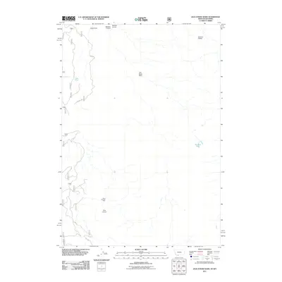
2011 Map of Jack Straw Basin
USGS Topo · Published 2011About this map
The Madison Plateau dominates this high-elevation landscape, where the Jack Straw Basin sits as a central drainage feature within the Gallatin County wilderness. The area is characterized by its high-altitude water features and complex topography, notably Big Bear Lake in the southeast and the smaller Frog Pond tucked along the western edge. A sparse network of forest service roads, including the primary Plateau Rd and FS 1700, provides the only access through this rugged territory. Human presence is minimal, anchored by the South Riverside Cabin near the southern boundary. Steep geological transitions are marked by Echo Canyon and Meadow Canyon, which carve through the plateau's edges. This 2011 survey captures the area's undeveloped character, preserving the exact layout of backcountry routes and remote landmarks used by researchers and wilderness travelers.
Find a feature on this map
25 named features on this map. Tap any name to fly to it.
Don’t see what you’re looking for? This feature index may not catch every label — zoom into the map to look around manually.
Map Details
Editions of this 2011 Jack Straw Basin Map
This is the sole edition of this map. No revisions or reprints were ever made.
Other maps of this area

1885 · Gallatin
USGS Topo · 1:125,000

1885 · Gallatin
USGS Topo · 1:125,000

1886 · Shoshone
USGS Topo · 1:125,000

1888 · Shoshone
USGS Topo · 1:125,000

1895 · Shoshone
USGS Topo · 1:125,000

1901 · Shoshone
USGS Topo · 1:125,000

1901 · Gallatin
USGS Topo · 1:125,000

1908 · Gallatin
USGS Topo · 1:125,000

1908 · Shoshone
USGS Topo · 1:125,000

1911 · Shoshone
USGS Topo · 1:125,000