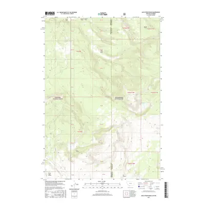
2017 Map of Jack Straw Basin
USGS Topo · Published 2017About this map
The Montana-Wyoming border cuts vertically through this high-elevation landscape, where the northern reaches of Yellowstone National Park meet the Gallatin National Forest. The map is dominated by a complex system of plateaus and basins, most notably the Madison Plateau and the Moose Creek Plateau, which frame the central depression of Jack Straw Basin. The drainage patterns here are distinct, with water collecting in small high-altitude features like Frog Pond and Big Bear Lake or carving through deep recesses such as Echo Canyon, Meadow Canyon, and Dry Canyon. This terrain illustrates the transition from the broad Madison Valley to the rugged volcanic tablelands that define this section of the Rocky Mountains. The absence of roads and permanent settlements underscores the protected, wild nature of this borderland during the early 21st century.
Find a feature on this map
33 named features on this map. Tap any name to fly to it.
Don’t see what you’re looking for? This feature index may not catch every label — zoom into the map to look around manually.
Map Details
Editions of this 2017 Jack Straw Basin Map
This is the sole edition of this map. No revisions or reprints were ever made.
Other maps of this area

1885 · Gallatin
USGS Topo · 1:125,000

1885 · Gallatin
USGS Topo · 1:125,000

1886 · Shoshone
USGS Topo · 1:125,000

1888 · Shoshone
USGS Topo · 1:125,000

1895 · Shoshone
USGS Topo · 1:125,000

1901 · Shoshone
USGS Topo · 1:125,000

1901 · Gallatin
USGS Topo · 1:125,000

1908 · Gallatin
USGS Topo · 1:125,000

1908 · Shoshone
USGS Topo · 1:125,000

1911 · Shoshone
USGS Topo · 1:125,000