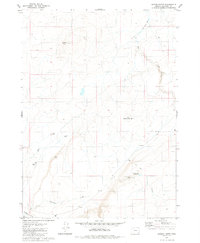
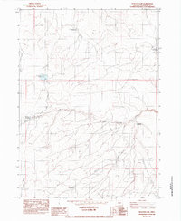
1980 Map of Jackies Butte
USGS Topo · Published 1980About this map
The high desert landscape of Malheur County is defined here by prominent volcanic landforms and a precarious water supply. Jackies Butte and Water Hole Butte serve as primary landmarks in this arid region, where the drainage network of Dry Creek, Bull Creek, and Chimney Creek suggests a seasonal and intermittent flow. Human activity is centered on livestock management and water access, evidenced by the Beber Ranch in the southwestern corner and several isolated improvements like the Grafton Well and Water Tank.
Find a feature on this map
13 named features on this map. Tap any name to fly to it.
Don’t see what you’re looking for? This feature index may not catch every label — zoom into the map to look around manually.
Map Details
Editions of this 1980 Jackies Butte Map
This is the sole edition of this map. No revisions or reprints were ever made.
Other maps of this area

1955 · Jordan Valley
USGS Topo · 1:250,000

1957 · Jordan Valley
USGS Topo · 1:250,000

1958 · Jordan Valley
USGS Topo · 1:250,000

1979 · Rockhouse Reservoir
USGS Topo · 1:24,000

1979 · Bowden Ranch
USGS Topo · 1:24,000
1979 · The Basin
USGS Topo · 1:24,000
1980 · Caviatta Ridge
USGS Topo · 1:24,000
1980 · Indian Fort
USGS Topo · 1:24,000

1982 · Rattlesnake Canyon
USGS Topo · 1:24,000
1982 · Peacock Lake
USGS Topo · 1:24,000