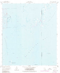
1953 Map of Jacko Bay
USGS Topo · Published 1980About this map
The Lake Barre Oil Field stands as a primary industrial landmark in this coastal Louisiana landscape, characterized by a complex network of canals and infrastructure cutting through the salt marshes. Surveyed in the 1950s and updated with late-1970s aerial data, the map reveals the extensive petroleum activity of the era, marked by numerous platforms, a Tower, and a Gas Well within the open waters.
Find a feature on this map
21 named features on this map. Tap any name to fly to it.
Don’t see what you’re looking for? This feature index may not catch every label — zoom into the map to look around manually.
Map Details
Editions of this 1953 Jacko Bay Map
3 editions found
Other maps of this area

1894 · Timbalier
USGS Topo · 1:62,500

1894 · Lake Felicity
USGS Topo · 1:62,500

1894 · Dulac
USGS Topo · 1:62,500

1935 · Bourbeux
USGS Topo · 1:31,680

1935 · Timbalier Island
USGS Topo · 1:31,680

1935 · Bay Courant
USGS Topo · 1:31,680

1935 · Pelican Pass
USGS Topo · 1:31,680

1935 · Calumet Island
USGS Topo · 1:31,680

1939 · Lake Felicity
USGS Topo · 1:62,500

1941 · Lake Felicity
USGS Topo · 1:62,500