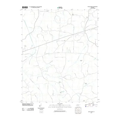
2010 Map of Jacks Creek
USGS Topo · Published 2010About this map
The South Fork Forked Deer River winds through the western reach of this Chester County landscape, joined by numerous tributaries like Clarks Creek, Jacks Creek, and the evocative Sweet Lips Creek. This area is defined by its deep ancestral roots, evidenced by the high density of family and community burial grounds including Holly Springs Cemetery, Massengill Cemetery, and Sweetlips Cemetery. The topography is shaped by water, from the confluence of Tar Creek and Higgins Creek to the artificial reservoir of Morris Lake, held by the Morris Dam. A dense network of local roads, such as Rabbit Ranch Rd and Hurt Cemetery Rd, connects these rural homesteads and ridges. Genealogists will find particular value in the distribution of smaller sites like Hamlet Cemetery and Robinson Cemetery, which remain anchored to the same creek-bottoms and hillsides that defined life here for generations.
Find a feature on this map
79 named features on this map. Tap any name to fly to it.
Don’t see what you’re looking for? This feature index may not catch every label — zoom into the map to look around manually.
Map Details
Editions of this 2010 Jacks Creek Map
This is the sole edition of this map. No revisions or reprints were ever made.
Other maps of this area

1936 · Leapwood
USGS Topo · 1:24,000

1936 · Enville
USGS Topo · 1:24,000

1936 · Life
USGS Topo · 1:24,000

1936 · Mt. Peter
USGS Topo · 1:24,000

1949 · Leapwood
USGS Topo · 1:24,000

1949 · Mt. Peter
USGS Topo · 1:24,000

1950 · Life
USGS Topo · 1:24,000

1950 · Enville
USGS Topo · 1:24,000

1953 · Beech Bluff
USGS Topo · 1:24,000

1955 · Luray
USGS Topo · 1:24,000