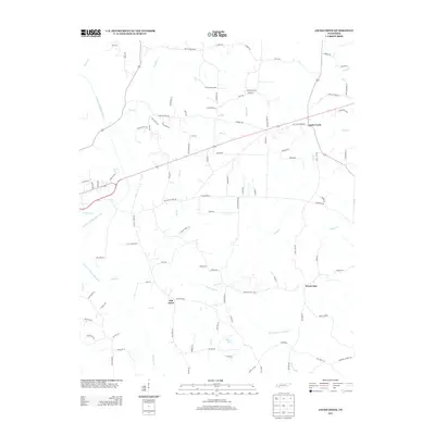
2013 Map of Jacks Creek
USGS Topo · Published 2013About this map
Jacks Creek and the surrounding Chester County countryside are defined by a network of small watercourses feeding the South Fork Forked Deer River. This 2013 survey illustrates the rural landscape near the settlements of Oak Grove and the colorfully named Sweet Lips. The area's history is preserved in its road names and cemetery sites, such as the Hurt Cemetery located north of the main village. The hydrology is complex, with Sweet Lips Cr and its Right Fork Sweet Lips Cr carving through the southern terrain near Morris Lake. Researchers can trace old family lands along routes like Hopewell Church Rd and Hurt Cemetery Rd, which indicate the locations of early community centers and homesteads that have long anchored this West Tennessee region.
Find a feature on this map
99 named features on this map. Tap any name to fly to it.
Don’t see what you’re looking for? This feature index may not catch every label — zoom into the map to look around manually.
Map Details
Editions of this 2013 Jacks Creek Map
This is the sole edition of this map. No revisions or reprints were ever made.
Other maps of this area

1936 · Leapwood
USGS Topo · 1:24,000

1936 · Enville
USGS Topo · 1:24,000

1936 · Life
USGS Topo · 1:24,000

1936 · Mt. Peter
USGS Topo · 1:24,000

1949 · Leapwood
USGS Topo · 1:24,000

1949 · Mt. Peter
USGS Topo · 1:24,000

1950 · Life
USGS Topo · 1:24,000

1950 · Enville
USGS Topo · 1:24,000

1953 · Beech Bluff
USGS Topo · 1:24,000

1955 · Luray
USGS Topo · 1:24,000