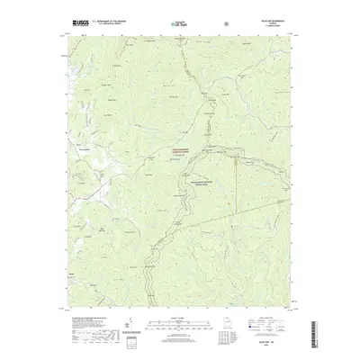
2020 Map of Jacks Gap
USGS Topo · Published 2020About this map
Brasstown Bald stands as the primary landmark of this North Georgia mountain landscape, marking the intersection of the Towns and Union county lines. The high-elevation terrain is defined by the Chattahoochee National Forest and the winding path of the Appalachian National Scenic Trail, which traverses numerous high points including Spaniards Knob and Jacks Knob. Small settlements and clusters of development like Fain and Hood are concentrated along the lower elevations and creek valleys, where forest service roads and local routes like Duck Gap Rd provide access to the interior ridges.
Find a feature on this map
142 named features on this map. Tap any name to fly to it.
Don’t see what you’re looking for? This feature index may not catch every label — zoom into the map to look around manually.
Map Details
Editions of this 2020 Jacks Gap Map
This is the sole edition of this map. No revisions or reprints were ever made.
Other maps of this area

1886 · Dahlonega
USGS Topo · 1:125,000

1892 · Dahlonega
USGS Topo · 1:125,000

1896 · Dahlonega
USGS Topo · 1:125,000

1903 · Dahlonega
USGS Topo · 1:125,000

1935 · Coosa Bald
USGS Topo · 1:24,000

1935 · Osborn
USGS Topo · 1:24,000

1935 · Cowrock
USGS Topo · 1:24,000

1935 · Tray Mountain
USGS Topo · 1:24,000
1935 · Gumlog
USGS Topo · 1:24,000

1935 · Jacks Gap
USGS Topo · 1:24,000