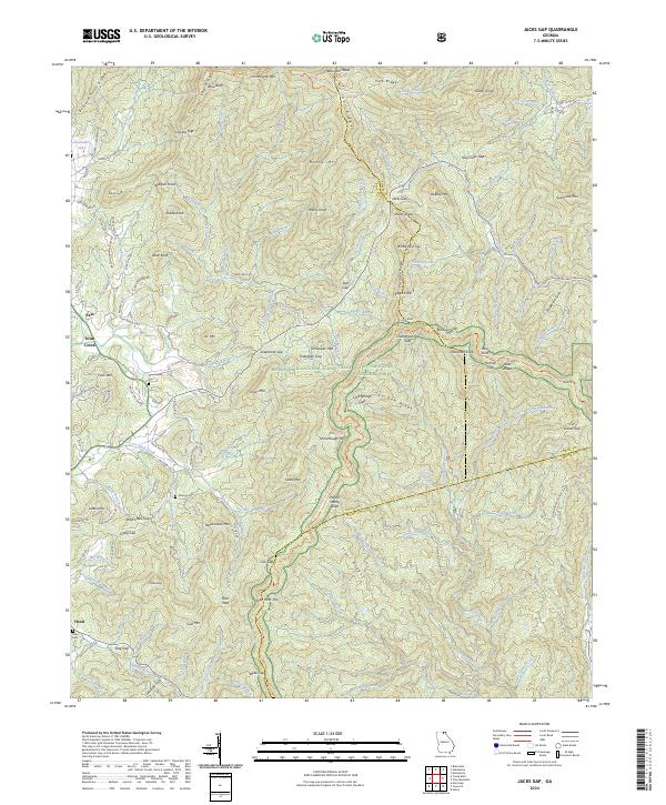
2024 Map of Jacks Gap
USGS Topo · Published 2024About this map
Brasstown Bald anchors the high ridgelines of the Blue Ridge Mountains in this modern survey of Union and Towns counties. The landscape is defined by the intersection of three major protected areas: the Chattahoochee National Forest, the Brasstown Wilderness, and the Mark Trail Wilderness. These steep slopes give rise to the headwaters of two significant southern drainage systems, with the Chattahoochee River flowing south and the Nottely River winding through the western valleys. Small settlements like Fain, Town Creek, and Hood occupy the lower elevations, where local roads such as Town Creek School Rd and Walnut Springs Rd provide access to rural homesteads. Genealogists can find several established burial grounds including Union Cem, New Liberty Cem, and Pinetop Cem, which remain tucked along the winding mountain passes and ridges.
Find a feature on this map
157 named features on this map. Tap any name to fly to it.
Don’t see what you’re looking for? This feature index may not catch every label — zoom into the map to look around manually.
Map Details
Editions of this 2024 Jacks Gap Map
This is the sole edition of this map. No revisions or reprints were ever made.
Other maps of this area

1886 · Dahlonega
USGS Topo · 1:125,000

1892 · Dahlonega
USGS Topo · 1:125,000

1896 · Dahlonega
USGS Topo · 1:125,000

1903 · Dahlonega
USGS Topo · 1:125,000

1935 · Coosa Bald
USGS Topo · 1:24,000

1935 · Osborn
USGS Topo · 1:24,000

1935 · Cowrock
USGS Topo · 1:24,000

1935 · Tray Mountain
USGS Topo · 1:24,000
1935 · Gumlog
USGS Topo · 1:24,000

1935 · Jacks Gap
USGS Topo · 1:24,000