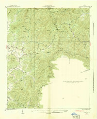
1938 Map of Jacks Gap
USGS Topo · Published 1938About this map
Brasstown Bald dominates the northern reaches of this 1938 survey, featuring the Brasstown Bald Lookout Tower at its summit along the border of Union and Towns counties. This high-elevation terrain is defined by the Chattahoochee National Forest and the winding path of the Appalachian Trail as it traverses the Blue Ridge. The map captures a pre-war rural landscape where human presence is concentrated in small mountain settlements and isolated landmarks.
Find a feature on this map
95 named features on this map. Tap any name to fly to it.
Don’t see what you’re looking for? This feature index may not catch every label — zoom into the map to look around manually.
Map Details
Editions of this 1938 Jacks Gap Map
This is the sole edition of this map. No revisions or reprints were ever made.
Other maps of this area

1886 · Dahlonega
USGS Topo · 1:125,000

1892 · Dahlonega
USGS Topo · 1:125,000

1896 · Dahlonega
USGS Topo · 1:125,000

1903 · Dahlonega
USGS Topo · 1:125,000

1935 · Coosa Bald
USGS Topo · 1:24,000

1935 · Osborn
USGS Topo · 1:24,000

1935 · Cowrock
USGS Topo · 1:24,000

1935 · Tray Mountain
USGS Topo · 1:24,000
1935 · Gumlog
USGS Topo · 1:24,000

1935 · Jacks Gap
USGS Topo · 1:24,000