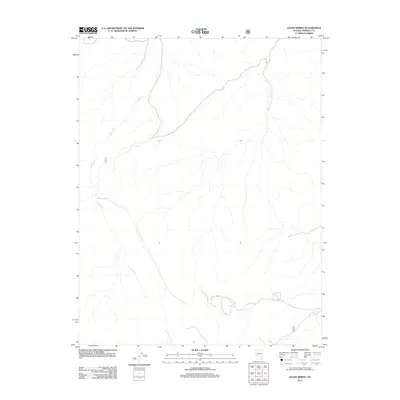
2012 Map of Jacks Spring
USGS Topo · Published 2012About this map
Jacks Cr and its surrounding drainage basins define the topography of this Mineral County landscape, as mapped by the U.S. Geological Survey in coordination with the U.S. Forest Service. The terrain is characterized by a network of intermittent watercourses and high-elevation relief, with the namesake Jacks Spring serving as a vital water source in an otherwise arid environment. This 2012 survey illustrates a sparsely developed region where the infrastructure is limited to primitive roads and forest tracks, typical of the high desert of western Nevada. The alignment of these routes, mapped by agencies including the U.S. Forest Service, reveals the historical patterns of land management and access within the public lands of the Great Basin.
Find a feature on this map
2 named features on this map. Tap any name to fly to it.
Don’t see what you’re looking for? This feature index may not catch every label — zoom into the map to look around manually.
Map Details
Editions of this 2012 Jacks Spring Map
This is the sole edition of this map. No revisions or reprints were ever made.
Other maps of this area

1909 · Hawthorne
USGS Topo · 1:250,000

1911 · Hawthorne
USGS Topo · 1:250,000

1914 · Mt. Morrison
USGS Topo · 1:125,000

1915 · Hawthorne
USGS Topo · 1:250,000

1917 · White Mountain
USGS Topo · 1:125,000

1947 · Mariposa
USGS Topo · 1:250,000

1948 · Walker Lake
USGS Topo · 1:250,000

1948 · Mariposa
USGS Topo · 1:250,000

1957 · Walker Lake
USGS Topo · 1:250,000

1957 · Mariposa
USGS Topo · 1:250,000