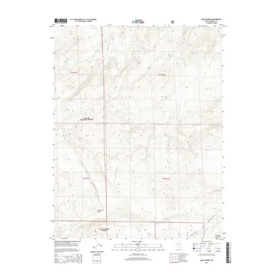
2014 Map of Jacks Spring
USGS Topo · Published 2014About this map
Jacks Spring serves as a vital water point in this high-elevation basin where the Toiyabe National Forest and Inyo National Forest meet. The landscape is defined by the steep transition from the Huntoon Mountains in the southeast into the depths of Jacks Spring Canyon. This remote corner of Mineral County highlights the early 21st-century cattle and ranching infrastructure that persists in the Great Basin, centered around the Truman Mdw Ranch and the seasonal flow of Jacks Cr. The map details the network of forest roads and range tracks, such as Truman Mdw Ranch Q-019, which provide access to this isolated wilderness area near the Nevada-California border.
Find a feature on this map
12 named features on this map. Tap any name to fly to it.
Don’t see what you’re looking for? This feature index may not catch every label — zoom into the map to look around manually.
Map Details
Editions of this 2014 Jacks Spring Map
This is the sole edition of this map. No revisions or reprints were ever made.
Other maps of this area

1909 · Hawthorne
USGS Topo · 1:250,000

1911 · Hawthorne
USGS Topo · 1:250,000

1914 · Mt. Morrison
USGS Topo · 1:125,000

1915 · Hawthorne
USGS Topo · 1:250,000

1917 · White Mountain
USGS Topo · 1:125,000

1947 · Mariposa
USGS Topo · 1:250,000

1948 · Walker Lake
USGS Topo · 1:250,000

1948 · Mariposa
USGS Topo · 1:250,000

1957 · Walker Lake
USGS Topo · 1:250,000

1957 · Mariposa
USGS Topo · 1:250,000