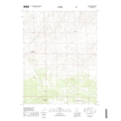
2018 Map of Jacks Spring
USGS Topo · Published 2018About this map
Toiyabe National Forest and the Inyo National Forest meet in this high-desert landscape of Mineral County, Nevada. The terrain is defined by the sharp descent of Jacks Spring Canyon and the critical water source at Jacks Spring, which feeds Jacks Cr as it flows through the western reaches of the quadrangle. The intersection of these national forests highlights a boundary of protected lands where the high altitude transitions toward the Great Basin. In the southeastern corner, the presence of the Truman Mdw Ranch indicates the sparse but vital human footprint in this arid environment, where proximity to water determines the location of both historical ranching operations and natural landmarks. The map illustrates the isolated character of this region, focusing on topographical elevations and the essential hydrological features that supported early travel and settlement in the Nevada backcountry.
Find a feature on this map
11 named features on this map. Tap any name to fly to it.
Don’t see what you’re looking for? This feature index may not catch every label — zoom into the map to look around manually.
Map Details
Editions of this 2018 Jacks Spring Map
This is the sole edition of this map. No revisions or reprints were ever made.
Other maps of this area

1909 · Hawthorne
USGS Topo · 1:250,000

1911 · Hawthorne
USGS Topo · 1:250,000

1914 · Mt. Morrison
USGS Topo · 1:125,000

1915 · Hawthorne
USGS Topo · 1:250,000

1917 · White Mountain
USGS Topo · 1:125,000

1947 · Mariposa
USGS Topo · 1:250,000

1948 · Walker Lake
USGS Topo · 1:250,000

1948 · Mariposa
USGS Topo · 1:250,000

1957 · Walker Lake
USGS Topo · 1:250,000

1957 · Mariposa
USGS Topo · 1:250,000