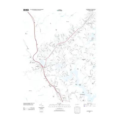
2013 Map of Jacksboro
USGS Topo · Published 2013About this map
Jacksboro and the surrounding Tennessee foothills are defined by a complex geography of narrow hollows and ridge-lines that separate the developed corridors from the expansive waters of Norris Lake. This 2013 survey documents a landscape where modern infrastructure like the Campbell County Airport and Interstate 75 coexist with traditional mountain landmarks. The topography is etched with numerous named hollows, including Bearwallow Hollow and Queener Hollow, reflecting a legacy of family settlement and land use. Water management and recreation are central to the area's character, visible in the proximity of Cove Lake and the various boat docks such as Twin Cove Boat Dock and Lindsay Mill Dock that line the jagged shores of the reservoir. To the west, the steep rise toward Fork Mountain and High Point creates a natural barrier, while the Indian Grave Tunnel serves as a critical engineering link through the terrain near Indian Gap.
Find a feature on this map
72 named features on this map. Tap any name to fly to it.
Don’t see what you’re looking for? This feature index may not catch every label — zoom into the map to look around manually.
Map Details
Editions of this 2013 Jacksboro Map
This is the sole edition of this map. No revisions or reprints were ever made.
Other maps of this area

1893 · Briceville
USGS Topo · 1:125,000

1895 · Briceville
USGS Topo · 1:125,000

1896 · Briceville
USGS Topo · 1:125,000

1936 · Ivydell
USGS Topo · 1:24,000

1936 · Block
USGS Topo · 1:24,000

1936 · Jacksboro
USGS Topo · 1:24,000

1936 · Pioneer
USGS Topo · 1:24,000

1936 · Duncan Flats
USGS Topo · 1:24,000

1936 · La Follette
USGS Topo · 1:48,000

1936 · Norris Dam
USGS Topo · 1:48,000