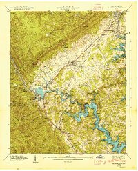
1946 Map of Jacksboro
USGS Topo · Published 1947About this map
Cumberland Mountain and Walden Ridge dominate this mid-century landscape where the industrial and natural worlds meet at the edge of the Tennessee Valley. The area is defined by the significant footprint of the Norris Reservoir, which floods Cove Creek Cove and creates the intricate shoreline surrounding Caryville. The map captures the infrastructure of the regional coal economy, featuring the High Point Mine, Sun Mines, and the strategic Indian Grave Tunnel used by the Southern Railway.
Find a feature on this map
71 named features on this map. Tap any name to fly to it.
Don’t see what you’re looking for? This feature index may not catch every label — zoom into the map to look around manually.
Map Details
Editions of this 1946 Jacksboro Map
This is the sole edition of this map. No revisions or reprints were ever made.
Other maps of this area

1893 · Briceville
USGS Topo · 1:125,000

1895 · Briceville
USGS Topo · 1:125,000

1896 · Briceville
USGS Topo · 1:125,000

1936 · Ivydell
USGS Topo · 1:24,000

1936 · Block
USGS Topo · 1:24,000

1936 · Jacksboro
USGS Topo · 1:24,000

1936 · Pioneer
USGS Topo · 1:24,000

1936 · Duncan Flats
USGS Topo · 1:24,000

1936 · La Follette
USGS Topo · 1:48,000

1936 · Norris Dam
USGS Topo · 1:48,000