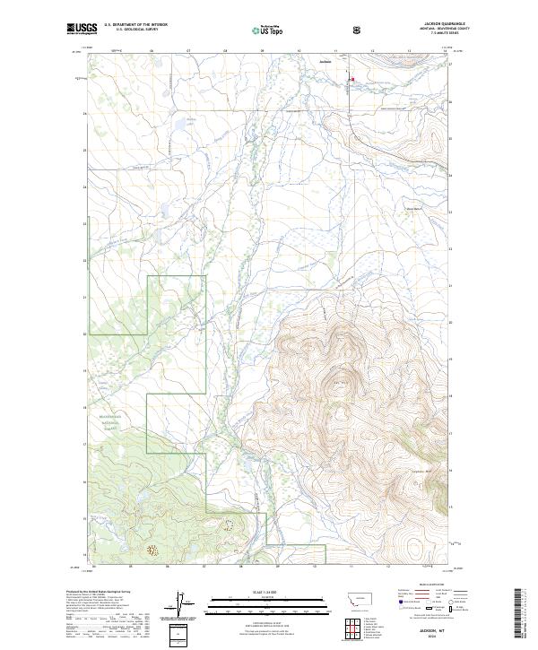
2024 Map of Jackson
USGS Topo · Published 2024About this map
The settlement of Jackson sits at the northern edge of a landscape defined by an intricate network of irrigation and water management, where the Big Hole River and Governor Creek meet the valley floor. This 2024 survey details the complex system of historical water rights and ranching infrastructure, evidenced by numerous named channels such as Jardine Ditch Number One, Laphan Ditch, and Hamby Ditch. These waterways support the high-country meadows between the steep slopes of Laphan Mtn and the prominent Davis Bench.
Find a feature on this map
44 named features on this map. Tap any name to fly to it.
Don’t see what you’re looking for? This feature index may not catch every label — zoom into the map to look around manually.
Map Details
Editions of this 2024 Jackson Map
This is the sole edition of this map. No revisions or reprints were ever made.
Other maps of this area

1955 · Dillon
USGS Topo · 1:250,000

1956 · Goldstone Mtn
USGS Topo · 1:62,500

1957 · Dillon
USGS Topo · 1:250,000

1958 · Dillon
USGS Topo · 1:250,000

1962 · Dillon
USGS Topo · 1:250,000

1965 · Dillon
USGS Topo · 1:250,000

1966 · Miner Lake
USGS Topo · 1:24,000
1966 · Ajax Ranch
USGS Topo · 1:24,000
1978 · Jackson
USGS Topo · 1:24,000

1978 · Butch Hill
USGS Topo · 1:24,000