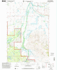
1997 Map of Jackson
USGS Topo · Published 2002About this map
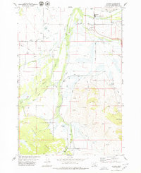
The settlement of Jackson serves as a focal point in this high-valley landscape, where ranching and thermal features define the local geography. Just north of the town center, Jardine Hot Spring and the Jackson Cemetery stand near the Big Hole River, while the Jackson Work Center and Johnson Ranch indicate the area's agricultural and administrative importance. This late-20th-century revision by the Forest Service highlights a complex system of water management, featuring the Jackson Ditch, Hamby DITCH, and Kirk Ditch that lace the valley floor to support local livestock and hay production.
Find a feature on this map
38 named features on this map. Tap any name to fly to it.
Don’t see what you’re looking for? This feature index may not catch every label — zoom into the map to look around manually.
Map Details
Editions of this 1997 Jackson Map
This is the sole edition of this map. No revisions or reprints were ever made.
Other maps of this area

1955 · Dillon
USGS Topo · 1:250,000
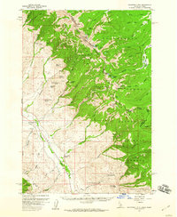
1956 · Goldstone Mtn
USGS Topo · 1:62,500

1957 · Dillon
USGS Topo · 1:250,000

1958 · Dillon
USGS Topo · 1:250,000

1962 · Dillon
USGS Topo · 1:250,000

1965 · Dillon
USGS Topo · 1:250,000
1966 · Miner Lake
USGS Topo · 1:24,000
1966 · Ajax Ranch
USGS Topo · 1:24,000
1978 · Jackson
USGS Topo · 1:24,000
1978 · Butch Hill
USGS Topo · 1:24,000