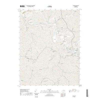
2019 Map of Jackson
USGS Topo · Published 2019About this map
The North Fork Kentucky River defines the winding geography of Breathitt County, carving deep loops like Rose Bend, Miller Bend, and Cy Bend through the Eastern Kentucky Coalfield. In the late 2010s, this landscape remains marked by the intricate network of narrow hollows and ridge-top cemeteries that define Appalachian settlement patterns. Engineering feats are visible in the form of the O and K Tunnel and the Chenowee Tunnel, which once supported the vital rail infrastructure required to navigate this dissected plateau. Small communities and family names anchor the map, from the riverside hamlet of Sewell in the north to Guerrant in the southwest. Local history is preserved in numerous upland burial sites like Gabbard Flat Cem and Kings Branch Cem, while landmarks such as High Knob and Picnic Hill offer perspective over the dense creek system of Cane Creek and Frozen Cr.
Find a feature on this map
116 named features on this map. Tap any name to fly to it.
Don’t see what you’re looking for? This feature index may not catch every label — zoom into the map to look around manually.
Map Details
Editions of this 2019 Jackson Map
This is the sole edition of this map. No revisions or reprints were ever made.
Other maps of this area

1889 · Salyersville
USGS Topo · 1:125,000

1891 · Manchester
USGS Topo · 1:125,000

1891 · Hazard
USGS Topo · 1:125,000

1891 · Salyersville
USGS Topo · 1:125,000

1892 · Beattyville
USGS Topo · 1:125,000

1899 · Salyersville
USGS Topo · 1:125,000

1913 · Buckhorn
USGS Topo · 1:62,500

1951 · Landsaw
USGS Topo · 1:24,000

1951 · Quicksand
USGS Topo · 1:24,000

1951 · Jackson
USGS Topo · 1:24,000