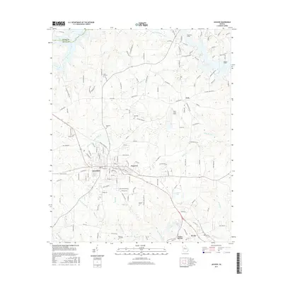
2017 Map of Jackson
USGS Topo · Published 2017About this map
The city of Jackson and the surrounding Butts County landscape are defined by the convergence of several major creeks and the expansive waters of Jackson Lake. To the north, the county boundary between Henry County and Butts County follows the course of Tussahaw Creek, which flows toward the lake under Hendricks Bridge. The area maintains a high density of ancestral landmarks, with family-named sites such as McMichael Cemetery and Etheredge Cemetery scattered across the rural tracts between Stark and Pepperton. The southern portion of the map transitions toward Indian Springs and Flovilla, where the terrain is carved by the Aboothlacoosta Creek and Plymale Creek drainages. This modern survey provides a detailed look at the infrastructure supporting the region, from the Seven Lakes Airport to the intricate network of local roads that link these long-standing Georgia communities.
Find a feature on this map
143 named features on this map. Tap any name to fly to it.
Don’t see what you’re looking for? This feature index may not catch every label — zoom into the map to look around manually.
Map Details
Editions of this 2017 Jackson Map
This is the sole edition of this map. No revisions or reprints were ever made.
Other maps of this area

1951 · Forsyth
USGS Topo · 1:62,500

1951 · Barnesville
USGS Topo · 1:62,500

1953 · Atlanta
USGS Topo · 1:250,000

1953 · Athens
USGS Topo · 1:250,000

1957 · Atlanta
USGS Topo · 1:250,000

1958 · Athens
USGS Topo · 1:250,000

1958 · Atlanta
USGS Topo · 1:250,000

1959 · Athens
USGS Topo · 1:250,000

1963 · Athens
USGS Topo · 1:250,000

1964 · Lloyd Shoals Dam
USGS Topo · 1:24,000