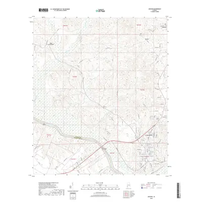
2018 Map of Jackson
USGS Topo · Published 2018About this map
The Tombigbee River serves as the primary geographic anchor for this section of Clarke and Washington Counties, carving a path that defines the local topography and commerce. Along its banks, features like the Saint Elmo Bar and the Joe C McCorquodale Junior Bridge indicate the river's enduring importance to regional transit. The city of Jackson dominates the southeastern quadrant, showing a detailed street grid including Commerce Street and College Avenue. Outside the city center, the landscape is dotted with smaller communities such as Mays Crossroads, Toddtown, and McVay. Genealogists will find a high concentration of burial sites, from Pine Crest Cem in town to rural locations like Leroy Cem and Peniel Cem. Numerous small waterways, including Jackson Creek and Stave Creek, snake through the terrain, feeding into the main river system.
Find a feature on this map
103 named features on this map. Tap any name to fly to it.
Don’t see what you’re looking for? This feature index may not catch every label — zoom into the map to look around manually.
Map Details
Editions of this 2018 Jackson Map
This is the sole edition of this map. No revisions or reprints were ever made.
Other maps of this area

1943 · Choctaw Bluff
USGS Topo · 1:62,500

1943 · McIntosh
USGS Topo · 1:62,500

1944 · McIntosh
USGS Topo · 1:62,500

1946 · Choctaw Bluff
USGS Topo · 1:62,500

1953 · Andalusia
USGS Topo · 1:250,000

1953 · Hattiesburg
USGS Topo · 1:250,000

1957 · Andalusia
USGS Topo · 1:250,000

1958 · Hattiesburg
USGS Topo · 1:250,000

1972 · Tattlersville
USGS Topo · 1:24,000

1972 · St. Stephens
USGS Topo · 1:24,000