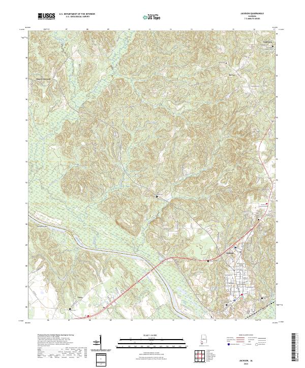
2024 Map of Jackson
USGS Topo · Published 2024About this map
The Tombigbee River serves as the dividing line between Clarke and Washington counties in this 2024 study of the Alabama landscape. Centered on the city of Jackson, the map illustrates a developed corridor along the riverbanks, where industry and transportation routes like Commerce St meet the water's edge. This modern survey provides a detailed view of several established communities including Leroy, Toddtown, and Mays Crossroads, while also preserving the locations of numerous family and church burial grounds such as McKenzie Cem, Pine Crest Cem, and the Bell-Parker Cem.
Find a feature on this map
107 named features on this map. Tap any name to fly to it.
Don’t see what you’re looking for? This feature index may not catch every label — zoom into the map to look around manually.
Map Details
Editions of this 2024 Jackson Map
This is the sole edition of this map. No revisions or reprints were ever made.
Other maps of this area

1943 · Choctaw Bluff
USGS Topo · 1:62,500

1943 · McIntosh
USGS Topo · 1:62,500

1944 · McIntosh
USGS Topo · 1:62,500

1946 · Choctaw Bluff
USGS Topo · 1:62,500

1953 · Andalusia
USGS Topo · 1:250,000

1953 · Hattiesburg
USGS Topo · 1:250,000

1957 · Andalusia
USGS Topo · 1:250,000

1958 · Hattiesburg
USGS Topo · 1:250,000

1972 · Tattlersville
USGS Topo · 1:24,000

1972 · St. Stephens
USGS Topo · 1:24,000