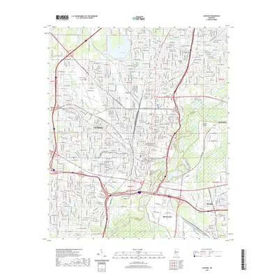
2020 Map of Jackson
USGS Topo · Published 2020About this map
Jackson anchors this capital city survey where the Pearl River divides Hinds and Rankin counties. The landscape transitions from the urban density of the city center to the industrial corridors of Richland and Pearl in the south and east. Higher ground is marked by Bailey Hill and the prominent Le Fleur Bluff, while the city’s academic and civic core is defined by Jackson State University, Millsaps College, and the complex of judicial buildings including the Carroll Gartin Justice Building - Supreme Court of Mississippi.
Find a feature on this map
143 named features on this map. Tap any name to fly to it.
Don’t see what you’re looking for? This feature index may not catch every label — zoom into the map to look around manually.
Map Details
Editions of this 2020 Jackson Map
This is the sole edition of this map. No revisions or reprints were ever made.
Other maps of this area

1903 · Jackson
USGS Topo · 1:125,000

1905 · Jackson
USGS Topo · 1:48,000

1906 · Florence
USGS Topo · 1:62,500

1908 · Jackson
USGS Topo · 1:62,500

1908 · Florence
USGS Topo · 1:62,500

1934 · Raymond
USGS Topo · 1:48,000

1937 · Raymond
USGS Topo · 1:62,500

1937 · Terry
USGS Topo · 1:48,000

1942 · Raymond
USGS Topo · 1:62,500

1943 · Terry
USGS Topo · 1:62,500