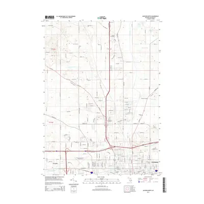
2014 Map of Jackson North
USGS Topo · Published 2014About this map
The Grand River winds through this landscape north of Jackson, charting the industrial and municipal growth of central Michigan in the early 21st century. The map reveals a dense network of local cemeteries, including Hillcrest Memorial Park Cem, Jackson County Cem, and Temple Beth Israel Cem, providing a significant record for genealogical research. The northern suburbs are characterized by a transition from the urban center to more open terrain near Woodville, where large-scale infrastructure like Jackson County Airport-Reynolds Field and the Baker College of Jackson campus have shaped the local footprint. Water management is a primary feature of the area, visible through the complex drainage systems of Twin Lakes Drain, Hurd Marvin Drain, and the Sandstone Blackman Drain, which support the agriculture and development surrounding the river's path.
Find a feature on this map
123 named features on this map. Tap any name to fly to it.
Don’t see what you’re looking for? This feature index may not catch every label — zoom into the map to look around manually.
Map Details
Editions of this 2014 Jackson North Map
This is the sole edition of this map. No revisions or reprints were ever made.
Other maps of this area

1919 · Springport
USGS Topo · 1:62,500

1919 · Rives Junction
USGS Topo · 1:62,500

1921 · Rives Junction
USGS Topo · 1:62,500

1921 · Springport
USGS Topo · 1:62,500

1935 · Jackson
USGS Topo · 1:48,000

1939 · Jackson
USGS Topo · 1:62,500

1948 · Spring Arbor
USGS Topo · 1:62,500

1949 · Spring Arbor
USGS Topo · 1:62,500

1958 · Grand Rapids
USGS Topo · 1:250,000

1961 · Grand Rapids
USGS Topo · 1:250,000
Featured Places
- Jackson, MI
- Tompkins Township, MI
- Blackman Charter Township, MI
- Rives Township, MI
- Sandstone Charter Township, MI