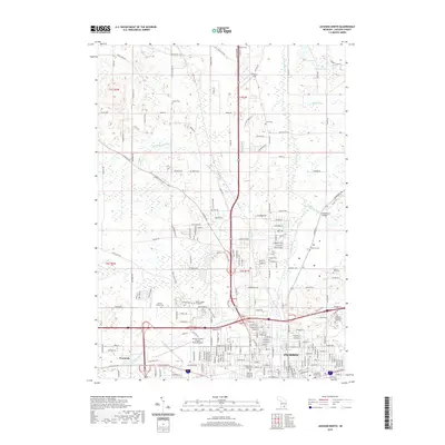
2019 Map of Jackson North
USGS Topo · Published 2019About this map
The Grand River and Portage River converge in this northern part of the city, where mid-century urban expansion meets the agricultural landscape of Jackson County. The 2019 survey documents a dense cluster of local history sites, including the Jackson County Cemetery and Temple Beth Israel Cemetery, alongside critical infrastructure like the Jackson County Airport-Reynolds Field. The map illustrates how modern transportation corridors and institutional developments, such as the Baker College of Jackson, have integrated with older rural landmarks like Woodville and several family-named burial grounds including Jones Cemetery and Draper Cemetery. This recent record provides a precise look at the drainage patterns of the Hurd Marvin Drain and Twin Lakes Drain, showing the complex hydrology of the area's lakes and wetlands before they meet the larger river systems.
Find a feature on this map
106 named features on this map. Tap any name to fly to it.
Don’t see what you’re looking for? This feature index may not catch every label — zoom into the map to look around manually.
Map Details
Editions of this 2019 Jackson North Map
This is the sole edition of this map. No revisions or reprints were ever made.
Other maps of this area

1919 · Springport
USGS Topo · 1:62,500

1919 · Rives Junction
USGS Topo · 1:62,500

1921 · Rives Junction
USGS Topo · 1:62,500

1921 · Springport
USGS Topo · 1:62,500

1935 · Jackson
USGS Topo · 1:48,000

1939 · Jackson
USGS Topo · 1:62,500

1948 · Spring Arbor
USGS Topo · 1:62,500

1949 · Spring Arbor
USGS Topo · 1:62,500

1958 · Grand Rapids
USGS Topo · 1:250,000

1961 · Grand Rapids
USGS Topo · 1:250,000
Featured Places
- Jackson, MI
- Tompkins Township, MI
- Blackman Charter Township, MI
- Rives Township, MI
- Sandstone Charter Township, MI