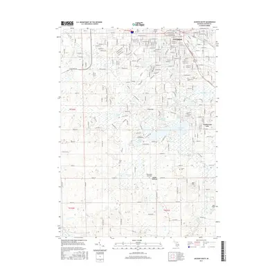
2017 Map of Jackson South
USGS Topo · Published 2017About this map
Jackson serves as the northern anchor of this landscape, where a dense grid of streets like W Michigan Ave and W Washington Ave meets the upper reaches of the Grand River. The map reveals a transition from the urban center of Jackson to the more aquatic and dispersed settlement patterns of the south, particularly around the substantial waters of Vandercook Lake. This area is notable for its concentration of communal sites, including several major cemeteries such as Mount Evergreen Cem and Saint Johns Cem, which offer significant genealogical data for the region.
Find a feature on this map
117 named features on this map. Tap any name to fly to it.
Don’t see what you’re looking for? This feature index may not catch every label — zoom into the map to look around manually.
Map Details
Editions of this 2017 Jackson South Map
This is the sole edition of this map. No revisions or reprints were ever made.
Other maps of this area

1919 · Springport
USGS Topo · 1:62,500

1919 · Rives Junction
USGS Topo · 1:62,500

1921 · Rives Junction
USGS Topo · 1:62,500

1921 · Springport
USGS Topo · 1:62,500

1935 · Jackson
USGS Topo · 1:48,000

1939 · Jackson
USGS Topo · 1:62,500

1948 · Spring Arbor
USGS Topo · 1:62,500

1949 · Spring Arbor
USGS Topo · 1:62,500

1958 · Grand Rapids
USGS Topo · 1:250,000

1961 · Grand Rapids
USGS Topo · 1:250,000
Featured Places
- Jackson, MI
- Spring Arbor Township, MI
- Vandercook Lake, MI
- Hanover Township, MI
- Blackman Charter Township, MI