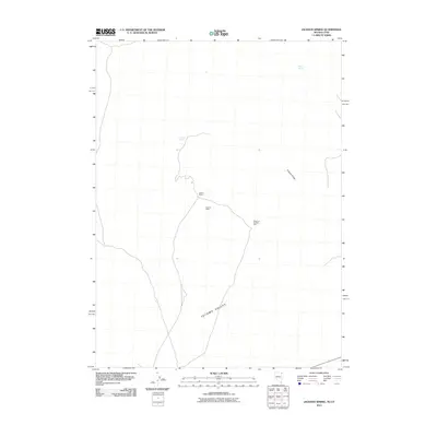
2011 Map of Jackson Spring
USGS Topo · Published 2011About this map
Jackson Mines and the nearby Durham Mine anchor this high-desert landscape in the northeastern corner of Nevada and western Utah. Situated along the eastern edge of the Tecoma Valley, these extraction sites are connected by a network of unimproved roads that trace the foot of the mountains. The geography here is defined by scarce water sources like Jackson Spring and Kilgore Spring, which likely dictated the placement of early mining operations and transport routes. To the east, Kilgore Ridge rises above the valley floor, marking the transition from the low-lying basin to the more complex terrain of the Pilot Range. The presence of the Queen of the West Mine further suggests the historical mineral interest that shaped this specific portion of the Great Basin during its development.
Find a feature on this map
7 named features on this map. Tap any name to fly to it.
Don’t see what you’re looking for? This feature index may not catch every label — zoom into the map to look around manually.
Map Details
Editions of this 2011 Jackson Spring Map
This is the sole edition of this map. No revisions or reprints were ever made.
Other maps of this area

1954 · Brigham City
USGS Topo · 1:250,000

1955 · Wells
USGS Topo · 1:250,000

1958 · Wells
USGS Topo · 1:250,000

1958 · Brigham City
USGS Topo · 1:250,000

1961 · Wells
USGS Topo · 1:250,000

1961 · Dairy Valley
USGS Topo · 1:62,500

1962 · Brigham City
USGS Topo · 1:250,000

1967 · Jackson Spring
USGS Topo · 1:24,000

1967 · Lucin
USGS Topo · 1:24,000

1967 · Twelvemile Ranch
USGS Topo · 1:24,000