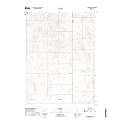
2018 Map of Jackson Spring
USGS Topo · Published 2018About this map
Jackson Spring serves as a critical water point in this high-desert landscape situated along the border of Utah and Nevada. The terrain is defined by the elevation changes between the Goose Creek Mountains and the lower Tecoma Valley, with the prominent Kilgore Ridge overlooking the dry expanses of Kilgore Basin. While the region appears largely undeveloped in this 2018 survey, the presence of isolated water sources like Kilgore Spring and the tracking of Kilgore Basin Rd reveal the essential infrastructure required for ranching or travel through the Great Basin. This map detail documents the intersection of Elko County and Box Elder County, where traditional land divisions of the Public Land Survey System meet the natural geography of the basin-and-range province.
Find a feature on this map
17 named features on this map. Tap any name to fly to it.
Don’t see what you’re looking for? This feature index may not catch every label — zoom into the map to look around manually.
Map Details
Editions of this 2018 Jackson Spring Map
This is the sole edition of this map. No revisions or reprints were ever made.
Other maps of this area

1954 · Brigham City
USGS Topo · 1:250,000

1955 · Wells
USGS Topo · 1:250,000

1958 · Wells
USGS Topo · 1:250,000

1958 · Brigham City
USGS Topo · 1:250,000

1961 · Wells
USGS Topo · 1:250,000

1961 · Dairy Valley
USGS Topo · 1:62,500

1962 · Brigham City
USGS Topo · 1:250,000

1967 · Jackson Spring
USGS Topo · 1:24,000

1967 · Lucin
USGS Topo · 1:24,000

1967 · Twelvemile Ranch
USGS Topo · 1:24,000