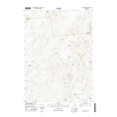
2016 Map of Jackson Summit
USGS Topo · Published 2016About this map
Tomantown and Jackson Summit anchor this landscape along the border of Hamilton and Fulton Counties, where a network of local roads like Tannery Rd and Tolemantown Rd connect small upland settlements. The area is defined by a series of peaks and ridges, including Shaker Mtn, Steele Mtn, and Bernhardt Mtn, which separate the various valley basins. Water management and drainage are prominent features of the geography, evidenced by the Jackson Summit Reservoir and Cameron Reservoir, alongside numerous vlys and swamps such as Johnson Swamp and Racker Vly. For those looking into local history or genealogy, the map identifies small, remote locations like Lindsley Corners and the Bleecker Cem, providing a clear view of the rural settlement patterns and high-country hydrology near the southern Adirondack foothills.
Find a feature on this map
58 named features on this map. Tap any name to fly to it.
Don’t see what you’re looking for? This feature index may not catch every label — zoom into the map to look around manually.
Map Details
Editions of this 2016 Jackson Summit Map
This is the sole edition of this map. No revisions or reprints were ever made.
Other maps of this area

1899 · Broadalbin
USGS Topo · 1:62,500

1902 · Broadalbin
USGS Topo · 1:62,500

1903 · Gloversville
USGS Topo · 1:62,500

1907 · Lake Pleasant
USGS Topo · 1:62,500

1910 · Stony Creek
USGS Topo · 1:62,500

1943 · Gloversville
USGS Topo · 1:62,500

1945 · Caroga Lake
USGS Topo · 1:24,000

1945 · Northville
USGS Topo · 1:24,000
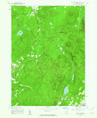
1945 · Jackson Summit
USGS Topo · 1:24,000
1945 · Broadalbin
USGS Topo · 1:24,000