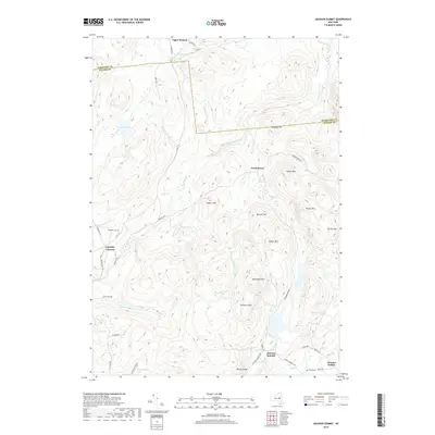
2019 Map of Jackson Summit
USGS Topo · Published 2019About this map
Jackson Summit sits at a high elevation within the Southern Adirondacks, anchoring a landscape defined by complex water systems and isolated mountain peaks. The map details the transition from the Hamilton Co line south into Fulton County, where the wilderness gives way to small rural clusters like Tomantown and Dennies Hollow. Water features are ubiquitous across the terrain, ranging from the broad reaches of Chase Lake and Mud Lake to the secluded Racker Vly and Lynus Vly.
Find a feature on this map
58 named features on this map. Tap any name to fly to it.
Don’t see what you’re looking for? This feature index may not catch every label — zoom into the map to look around manually.
Map Details
Editions of this 2019 Jackson Summit Map
This is the sole edition of this map. No revisions or reprints were ever made.
Other maps of this area

1899 · Broadalbin
USGS Topo · 1:62,500

1902 · Broadalbin
USGS Topo · 1:62,500

1903 · Gloversville
USGS Topo · 1:62,500

1907 · Lake Pleasant
USGS Topo · 1:62,500

1910 · Stony Creek
USGS Topo · 1:62,500

1943 · Gloversville
USGS Topo · 1:62,500

1945 · Caroga Lake
USGS Topo · 1:24,000

1945 · Northville
USGS Topo · 1:24,000
1945 · Jackson Summit
USGS Topo · 1:24,000
1945 · Broadalbin
USGS Topo · 1:24,000