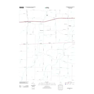
2013 Map of Jacksonburg
USGS Topo · Published 2013About this map
Hoover Mill and the intricate network of the Greens Fork watershed define this rural landscape in western Wayne County. The settlement pattern is characterized by small, established communities such as Jacksonburg, Hiser, and Pinhook, many situated at the intersection of early county roads. The drainage of the land is meticulously documented, showing the transition from natural waterways like Nolands Fork and Snow Run Brook to engineered infrastructure such as Gephart Ditch.
Find a feature on this map
94 named features on this map. Tap any name to fly to it.
Don’t see what you’re looking for? This feature index may not catch every label — zoom into the map to look around manually.
Map Details
Editions of this 2013 Jacksonburg Map
This is the sole edition of this map. No revisions or reprints were ever made.
Other maps of this area

1915 · New Paris
USGS Topo · 1:48,000

1915 · College Corner
USGS Topo · 1:48,000

1918 · College Corner
USGS Topo · 1:62,500

1918 · New Paris
USGS Topo · 1:62,500

1953 · Cincinnati
USGS Topo · 1:250,000

1956 · Brownsville
USGS Topo · 1:24,000

1956 · Connersville
USGS Topo · 1:24,000

1957 · Cincinnati
USGS Topo · 1:250,000

1960 · Liberty
USGS Topo · 1:24,000
1960 · Hagerstown
USGS Topo · 1:24,000