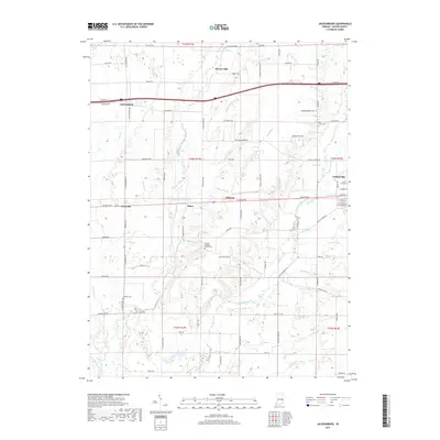
2019 Map of Jacksonburg
USGS Topo · Published 2019About this map
Centerville marks the eastern edge of this agricultural landscape in Wayne County, where the terrain is defined by a dense network of watercourses including Nolands Fork and Greens Fork. Small, historic settlements like Jacksonburg, Pennville, and Pinhook anchor the rural road system, while localized clusters of homes appear at Hiser. The map reveals a high concentration of burial grounds and religious sites essential for genealogical research, such as the United Brethren Church Cem, West Grove Cem, and Crown Hill Cem.
Find a feature on this map
107 named features on this map. Tap any name to fly to it.
Don’t see what you’re looking for? This feature index may not catch every label — zoom into the map to look around manually.
Map Details
Editions of this 2019 Jacksonburg Map
This is the sole edition of this map. No revisions or reprints were ever made.
Other maps of this area

1915 · New Paris
USGS Topo · 1:48,000

1915 · College Corner
USGS Topo · 1:48,000

1918 · College Corner
USGS Topo · 1:62,500

1918 · New Paris
USGS Topo · 1:62,500

1953 · Cincinnati
USGS Topo · 1:250,000

1956 · Brownsville
USGS Topo · 1:24,000

1956 · Connersville
USGS Topo · 1:24,000

1957 · Cincinnati
USGS Topo · 1:250,000

1960 · Liberty
USGS Topo · 1:24,000
1960 · Hagerstown
USGS Topo · 1:24,000