Loading...
Loading map...2022 Map of Jacksonburg
USGS Topo · Published 2022About this map
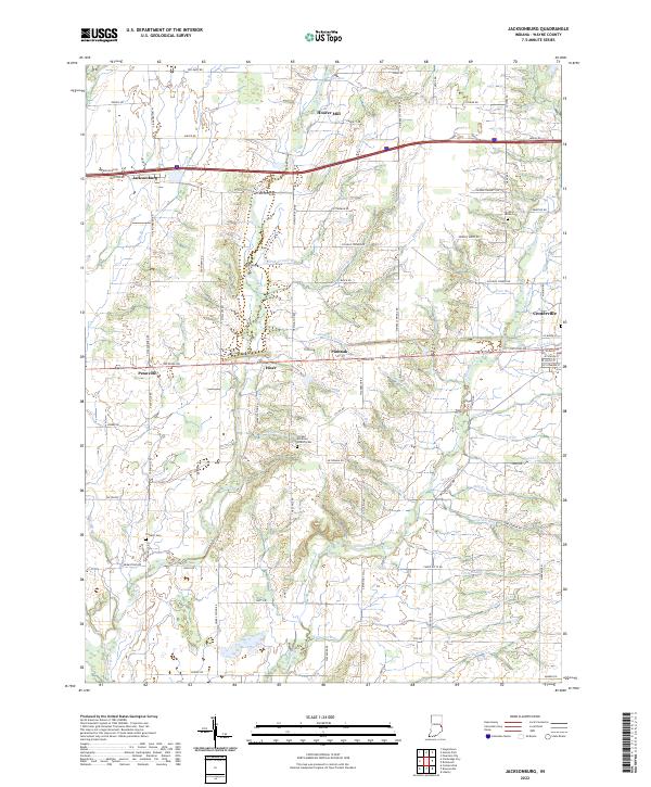
Nolands Fork and Greens Fork carve a network of drainage across this rural Wayne County landscape, where small agricultural hamlets like Jacksonburg and Pennville remain anchored by historical landmarks. The map documents several significant family and community sites, including the United Brethren Church Cem and the Franklin Cem. Near the northern edge, Hoover Mill stands as a marker of early water-powered industry along Our Run.
Find a feature on this map
73 named features on this map. Tap any name to fly to it.
Don’t see what you’re looking for? This feature index may not catch every label — zoom into the map to look around manually.
Map Details
Date Portrayed2022
Date Published2022
PublisherU.S. Geological Survey
Map TypeTopographic
Scale1:24000
Physical Dimensions24 x 29 inches
Editions of this 2022 Jacksonburg Map
This is the sole edition of this map. No revisions or reprints were ever made.
Historical Maps of Pinhook Through Time
Featured Locations
Source Details
SourceU.S. Geological Survey
CopyrightPublic Domain