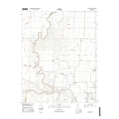
2017 Map of Jacksonport
USGS Topo · Published 2017About this map
The Black River meanders toward its confluence with the White River near the historic river town of Jacksonport. This 2017 survey details the intricate hydrology of the Arkansas Delta, where numerous backwaters like Brush Lake, Eagle Lake, and Horseshoe Lake define the terrain between the river channels. The landscape is dotted with small rural cemeteries, such as Shiloh Cem and Hickory Grove Cem, which serve as vital markers for genealogical research in this part of Jackson County.
Find a feature on this map
99 named features on this map. Tap any name to fly to it.
Don’t see what you’re looking for? This feature index may not catch every label — zoom into the map to look around manually.
Map Details
Editions of this 2017 Jacksonport Map
This is the sole edition of this map. No revisions or reprints were ever made.
Other maps of this area

1932 · Strawberry
USGS Topo · 1:62,500

1935 · Alicia
USGS Topo · 1:62,500

1935 · Strawberry
USGS Topo · 1:62,500

1935 · Newport
USGS Topo · 1:62,500

1935 · Tuckerman
USGS Topo · 1:62,500

1941 · Strawberry
USGS Topo · 1:62,500

1953 · Memphis
USGS Topo · 1:250,000

1954 · Charlotte
USGS Topo · 1:24,000

1955 · Cord
USGS Topo · 1:24,000

1956 · Memphis
USGS Topo · 1:250,000