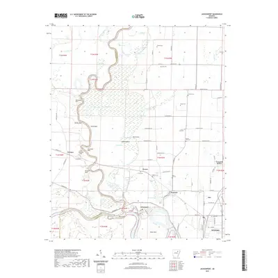
2020 Map of Jacksonport
USGS Topo · Published 2020About this map
The confluence of the White River and the Black River at Jacksonport defines this river-driven landscape on the edge of the Mississippi Alluvial Plain. The map documents a terrain defined by oxbows, brakes, and ridges, where the water's path has carved out distinctive features like Dead Mule Bend, Pullum Bend, and Mason Bend. Higher ground is marked by Surrounded Hill and various bluffs, including Berkley Bluff and Little Paroquet Bluff, which offered stable ground for early settlements and river landings.
Find a feature on this map
106 named features on this map. Tap any name to fly to it.
Don’t see what you’re looking for? This feature index may not catch every label — zoom into the map to look around manually.
Map Details
Editions of this 2020 Jacksonport Map
This is the sole edition of this map. No revisions or reprints were ever made.
Other maps of this area

1932 · Strawberry
USGS Topo · 1:62,500

1935 · Alicia
USGS Topo · 1:62,500

1935 · Strawberry
USGS Topo · 1:62,500

1935 · Newport
USGS Topo · 1:62,500

1935 · Tuckerman
USGS Topo · 1:62,500

1941 · Strawberry
USGS Topo · 1:62,500

1953 · Memphis
USGS Topo · 1:250,000

1954 · Charlotte
USGS Topo · 1:24,000

1955 · Cord
USGS Topo · 1:24,000

1956 · Memphis
USGS Topo · 1:250,000