2024 Map of Jacksonport
USGS Topo · Published 2024About this map
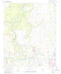
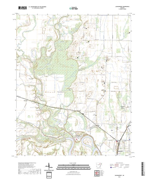
Jacksonport stands at the strategic confluence of the Black River and the White River, a location traditionally vital to the riverine economy of Jackson County. This landscape is defined by the complex hydrology of the river bottoms, where numerous oxbows and swampy depressions like Horseshoe Lake, Eagle Lake, and Tupelo Brake reflect the shifting historical courses of these waterways. The map captures the transition from the wet lowlands of Black Island to the higher ground where settlements such as Diaz and Campbell Station are established along the rail and highway corridors.
Find a feature on this map
108 named features on this map. Tap any name to fly to it.
Don’t see what you’re looking for? This feature index may not catch every label — zoom into the map to look around manually.
Map Details
Editions of this 2024 Jacksonport Map
This is the sole edition of this map. No revisions or reprints were ever made.