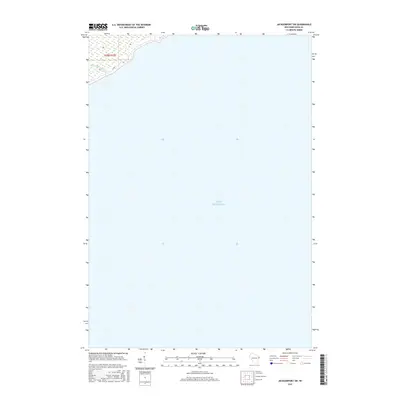
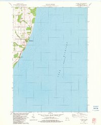
2015 Map of Jacksonport SW
USGS Topo · Published 2015About this map
Lake Michigan dominates this coastal survey of the Door County shoreline, capturing the water's expanse east of the Sevastopol area. In the northwestern corner, the mouth of Shivering Sands Creek meets the lake, a feature that anchors the local drainage system. The terrestrial portion of the map is largely defined by the township and range lines of T28N R27E, with County Road T providing the primary transit route near the coast. The absence of dense inland development underscores the natural character of the shoreline in this specific sector during the mid-2010s, focusing heavily on the maritime boundary and the immediate wetland environment surrounding the creek.
Find a feature on this map
3 named features on this map. Tap any name to fly to it.
Don’t see what you’re looking for? This feature index may not catch every label — zoom into the map to look around manually.
Map Details
Editions of this 2015 Jacksonport SW Map
This is the sole edition of this map. No revisions or reprints were ever made.
Other maps of this area

1954 · Manitowoc
USGS Topo · 1:250,000

1958 · Manitowoc
USGS Topo · 1:250,000

1960 · Sturgeon Bay
USGS Topo · 1:62,500

1960 · Jacksonport
USGS Topo · 1:62,500

1960 · Algoma
USGS Topo · 1:62,500

1981 · Institute
USGS Topo · 1:24,000
1981 · Sturgeon Bay East
USGS Topo · 1:24,000
1982 · Jacksonport
USGS Topo · 1:24,000
1982 · Jacksonport SW
USGS Topo · 1:24,000
1982 · Algoma NE
USGS Topo · 1:24,000