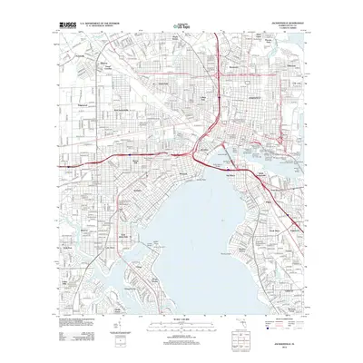
2012 Map of Jacksonville
USGS Topo · Published 2012About this map
St Johns River defines the urban and industrial heart of this landscape, carving through established neighborhoods and dense port facilities. The riverfront is a complex network of maritime commerce and civic infrastructure, featuring the Jacksonville Shipyards Wharf, EverBank Field, and numerous shipping piers. Residential growth is visible in the distinct layouts of Riverside, San Marco, and Avondale, while historical depth is found in the large acreage of The Evergreen Cem and Oaklawn Cem. Institutional landmarks such as Waters College and the Florida Community College - Kent Campus highlight the area's role as an educational hub. This survey illustrates the intricate relationship between the winding Ortega River and the varied residential districts like Ortega Terrace and Ortega Forest, showing how the water both separates and connects the city's diverse communities.
Find a feature on this map
96 named features on this map. Tap any name to fly to it.
Don’t see what you’re looking for? This feature index may not catch every label — zoom into the map to look around manually.
Map Details
Editions of this 2012 Jacksonville Map
This is the sole edition of this map. No revisions or reprints were ever made.
Other maps of this area

1917 · Orange Park
USGS Topo · 1:62,500

1917 · Cambon
USGS Topo · 1:62,500

1918 · Middleburg
USGS Topo · 1:62,500

1918 · Cambon
USGS Topo · 1:62,500

1918 · Jacksonville
USGS Topo · 1:62,500

1918 · Orange Park
USGS Topo · 1:62,500

1941 · Middleburg
USGS Topo · 1:62,500

1948 · Jacksonville
USGS Topo · 1:250,000

1948 · Eastport
USGS Topo · 1:24,000

1949 · Jacksonville Heights
USGS Topo · 1:24,000
Featured Places
- Jacksonville, FL
- Grand Crossing, Jacksonville
- Pearl Court, Jacksonville
- Edgewood, Jacksonville
- Royal Terrace, Jacksonville