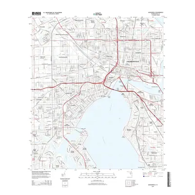
2015 Map of Jacksonville
USGS Topo · Published 2015About this map
Jacksonville and its surrounding neighborhoods are defined by the wide sweep of the Saint Johns River, which separates the urban core from the riverfront residential districts. The landscape is a complex network of established communities like Springfield, Riverside, and Avondale, stitched together by major spans including the Acosta Bridge and the Main Street Bridge. To the north and west, neighborhoods like Grand Crossing and Biltmore indicate the city's historic expansion along rail and road corridors, while the industrial character of Talleyrand remains evident along the river's eastern banks. Education and remembrance are centered at landmarks such as Edward Waters Coll and the expansive grounds of The Evergreen Cem. The confluence of smaller waterways like McCoys Creek and the Ortega River further shapes the city's unique geography, creating distinct pockets of development and natural waterfront.
Find a feature on this map
86 named features on this map. Tap any name to fly to it.
Don’t see what you’re looking for? This feature index may not catch every label — zoom into the map to look around manually.
Map Details
Editions of this 2015 Jacksonville Map
This is the sole edition of this map. No revisions or reprints were ever made.
Other maps of this area

1917 · Orange Park
USGS Topo · 1:62,500

1917 · Cambon
USGS Topo · 1:62,500

1918 · Middleburg
USGS Topo · 1:62,500

1918 · Cambon
USGS Topo · 1:62,500

1918 · Jacksonville
USGS Topo · 1:62,500

1918 · Orange Park
USGS Topo · 1:62,500

1941 · Middleburg
USGS Topo · 1:62,500

1948 · Jacksonville
USGS Topo · 1:250,000

1948 · Eastport
USGS Topo · 1:24,000

1949 · Jacksonville Heights
USGS Topo · 1:24,000
Featured Places
- Jacksonville, FL
- Grand Crossing, Jacksonville
- Pearl Court, Jacksonville
- Edgewood, Jacksonville
- Royal Terrace, Jacksonville