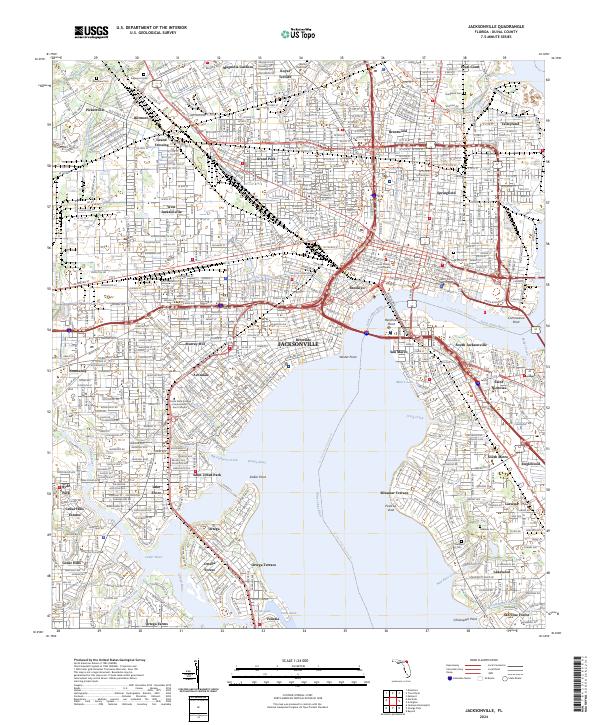
2024 Map of Jacksonville
USGS Topo · Published 2024About this map
The Saint Johns River dominates this modern view of the Florida coast, where the urban core of Jacksonville meets a complex network of residential neighborhoods and industrial waterfronts. From the historic streets of Springfield and Riverside to the established southern communities of Ortega and San Marco, the map reveals a city defined by its relationship to the water. The landscape is segmented by numerous tributaries including the Ortega River, Cedar River, and McCoy Creek, with prominent landmarks like the Duval County Courthouse and Edward Waters College anchoring the downtown and midtown districts. Large institutional tracts are clearly visible, such as the extensive grounds of Evergreen Cem and Westview Cem. Infrastructure is dense throughout the quadrangle, with the SCL RR lines and major boulevards serving neighborhoods like Grand Park, Murray Hill, and Saint Nicholas.
Find a feature on this map
164 named features on this map. Tap any name to fly to it.
Don’t see what you’re looking for? This feature index may not catch every label — zoom into the map to look around manually.
Map Details
Editions of this 2024 Jacksonville Map
This is the sole edition of this map. No revisions or reprints were ever made.
Other maps of this area

1917 · Orange Park
USGS Topo · 1:62,500

1917 · Cambon
USGS Topo · 1:62,500

1918 · Middleburg
USGS Topo · 1:62,500

1918 · Cambon
USGS Topo · 1:62,500

1918 · Jacksonville
USGS Topo · 1:62,500

1918 · Orange Park
USGS Topo · 1:62,500

1941 · Middleburg
USGS Topo · 1:62,500

1948 · Jacksonville
USGS Topo · 1:250,000

1948 · Eastport
USGS Topo · 1:24,000

1949 · Jacksonville Heights
USGS Topo · 1:24,000
Featured Places
- Jacksonville, FL
- Biltmore, Jacksonville
- Talleyrand, Jacksonville
- Grand Crossing, Jacksonville
- Lake Shore, Jacksonville