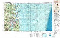
1988 Map of Jacksonville
USGS Topo · Published 1988About this map
The St Johns River serves as the central artery of this coastal survey, where the urban expansion of Jacksonville meets the sprawling waterways of the Atlantic seaboard. In the late 1980s, the region's strategic military importance is clearly visible, anchored by the Kings Bay Submarine Base in Georgia and the Fuel Depot (U S Navy) near the coast. The map captures the delicate balance between high-density development and protected natural areas, showcasing the chain of barrier islands including Cumberland Island and Amelia Island. Transport networks like the Seaboard System and Southern Railway underscore the area's role as a major logistics hub. Farther inland, the massive Camp Blanding Military Reservation dominates the landscape south of Orange Park, illustrating the vast tracts of land dedicated to defense and conservation during this era.
Find a feature on this map
56 named features on this map. Tap any name to fly to it.
Don’t see what you’re looking for? This feature index may not catch every label — zoom into the map to look around manually.
Map Details
Editions of this 1988 Jacksonville Map
This is the sole edition of this map. No revisions or reprints were ever made.
Other maps of this area

1917 · Orange Park
USGS Topo · 1:62,500

1917 · Nahunta
USGS Topo · 1:62,500

1917 · Cambon
USGS Topo · 1:62,500

1917 · Boulogne
USGS Topo · 1:62,500

1917 · Macclenny
USGS Topo · 1:62,500

1917 · Hilliard
USGS Topo · 1:62,500

1918 · St Marys
USGS Topo · 1:62,500

1918 · Cumberland Island
USGS Topo · 1:62,500

1918 · Folkston
USGS Topo · 1:62,500

1918 · Middleburg
USGS Topo · 1:62,500