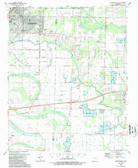
1987 Map of Jacksonville
USGS Topo · Published 1987About this map
Bayou Meto and its intricate network of levees dominate this landscape east of Jacksonville, where the transition from urban streets to managed wetlands is clearly defined. The area is characterized by a high density of rural landmarks, including family-named cemeteries like McCraw Cem and Cherry Cem, and community anchors such as South Bend Ch and Mt Ararat Ch. The expansion of Jacksonville is evident in the residential grid featuring Northside Jr High Sch and several local parks like Excell Park. To the east, the Holland Bottoms State Wildlife Management Area represents a significant preservation of the natural riverine environment. This mid-1980s data also captures the local agricultural economy, marked by numerous fish farms and landing strips scattered across the floodplains, alongside the critical Union Pacific rail corridor.
Find a feature on this map
52 named features on this map. Tap any name to fly to it.
Don’t see what you’re looking for? This feature index may not catch every label — zoom into the map to look around manually.
Map Details
Editions of this 1987 Jacksonville Map
2 editions found
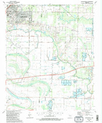
Other maps of this area

1891 · Little Rock
USGS Topo · 1:125,000

1893 · Little Rock
USGS Topo · 1:125,000

1935 · Mc Almont
USGS Topo · 1:24,000

1935 · Sweet Home
USGS Topo · 1:24,000

1937 · England
USGS Topo · 1:48,000

1940 · Lonoke
USGS Topo · 1:62,500

1941 · Olmstead
USGS Topo · 1:31,680

1941 · Cabot
USGS Topo · 1:31,680

1942 · Scott
USGS Topo · 1:31,680

1943 · England
USGS Topo · 1:62,500