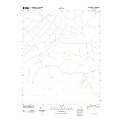
2010 Map of Jacksonville NE
USGS Topo · Published 2010About this map
The White Oak River and its intricate network of tributaries define this coastal plain landscape in Onslow County. The river system includes the South Prong White Oak River and Fork Branch, creating a low-lying geography that has historically shaped local travel and land use. Settlement is concentrated at Gibson Fork, where rural routes converge near Gibson Branch. Modern aviation and infrastructure are represented by the Bell Strip Airport in the northeast corner and the Gibson Bridge, which provides a vital crossing over the main river channel. Numerous named waterways like Little Hell Creek, Beaverdam Branch, and Chinkapin Branch underscore the area's riparian character. The map also traces established rural corridors such as Oak Grove Rd and White Oak River Rd, which connect the scattered homesteads and farming tracts of the region.
Find a feature on this map
23 named features on this map. Tap any name to fly to it.
Don’t see what you’re looking for? This feature index may not catch every label — zoom into the map to look around manually.
Map Details
Editions of this 2010 Jacksonville NE Map
This is the sole edition of this map. No revisions or reprints were ever made.
Other maps of this area

1901 · New Bern
USGS Topo · 1:62,500

1903 · New Bern
USGS Topo · 1:62,500

1903 · Trent River
USGS Topo · 1:62,500

1904 · Trent River
USGS Topo · 1:62,500

1942 · Maysville
USGS Topo · 1:62,500

1943 · Jacksonville
USGS Topo · 1:62,500

1948 · Maysville
USGS Topo · 1:62,500

1950 · Pollocksville
USGS Topo · 1:24,000

1953 · Rocky Mount
USGS Topo · 1:250,000

1953 · Beaufort
USGS Topo · 1:250,000