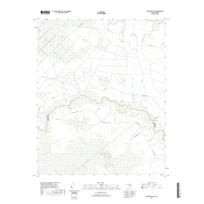
2019 Map of Jacksonville NE
USGS Topo · Published 2019About this map
The White Oak River and its intricate drainage network define this coastal North Carolina landscape on the border of Jones and Onslow Counties. The terrain is dominated by the White Oak Pocosin, a vast wetland system that influences the local settlement patterns. Small communities like Emmett and Bell Strip are connected by a network of rural roads such as White Oak River Rd and Lees Chapel Rd, which navigate around the numerous tributaries including Mill Run, Little Hell Cr, and Beaverdam Br. The map reveals a rural economy shaped by the natural hydrology, with Gibson Bridge serving as a key crossing point for Gibson Bridge Rd. This survey documents the persistent wilderness of the pocosin alongside the established agricultural and residential pockets at Parker Field and Olivers Crossroads.
Find a feature on this map
36 named features on this map. Tap any name to fly to it.
Don’t see what you’re looking for? This feature index may not catch every label — zoom into the map to look around manually.
Map Details
Editions of this 2019 Jacksonville NE Map
This is the sole edition of this map. No revisions or reprints were ever made.
Other maps of this area

1901 · New Bern
USGS Topo · 1:62,500

1903 · New Bern
USGS Topo · 1:62,500

1903 · Trent River
USGS Topo · 1:62,500

1904 · Trent River
USGS Topo · 1:62,500

1942 · Maysville
USGS Topo · 1:62,500

1943 · Jacksonville
USGS Topo · 1:62,500

1948 · Maysville
USGS Topo · 1:62,500

1950 · Pollocksville
USGS Topo · 1:24,000

1953 · Rocky Mount
USGS Topo · 1:250,000

1953 · Beaufort
USGS Topo · 1:250,000