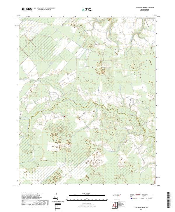
2022 Map of Jacksonville NE
USGS Topo · Published 2022About this map
The White Oak River serves as the central artery for this coastal plain landscape, defining the boundary between Jones and Onslow counties. The terrain is characterized by its significant wetland systems, most notably the White Oak Pocosin, an evergreen shrub bog typical of the Carolina coastal region. This 2022 survey illustrates a sparse settlement pattern dominated by rural roads and small locales such as Emmett, Parker Field, and Bell Strip. The hydrology is complex, with numerous tributaries including Little Hell Cr, Mundine Br, and Beaverdam Br feeding into the main river channel. Local transit is managed through a network of rural routes like Olivers Crossroads Rd and Black Swamp Trl, reflecting a landscape where the natural water drainage and pocosin wetlands dictate the placement of human infrastructure and agricultural clearings.
Find a feature on this map
34 named features on this map. Tap any name to fly to it.
Don’t see what you’re looking for? This feature index may not catch every label — zoom into the map to look around manually.
Map Details
Editions of this 2022 Jacksonville NE Map
This is the sole edition of this map. No revisions or reprints were ever made.
Other maps of this area

1901 · New Bern
USGS Topo · 1:62,500

1903 · New Bern
USGS Topo · 1:62,500

1903 · Trent River
USGS Topo · 1:62,500

1904 · Trent River
USGS Topo · 1:62,500

1942 · Maysville
USGS Topo · 1:62,500

1943 · Jacksonville
USGS Topo · 1:62,500

1948 · Maysville
USGS Topo · 1:62,500

1950 · Pollocksville
USGS Topo · 1:24,000

1953 · Rocky Mount
USGS Topo · 1:250,000

1953 · Beaufort
USGS Topo · 1:250,000