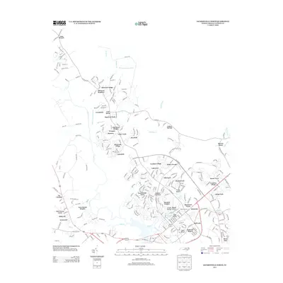
2013 Map of Jacksonville North
USGS Topo · Published 2013About this map
Bachelors Delight Swamp and its tributary Huffmans Br drain the northern reaches of this landscape, where residential development begins to thin into the wetlands of Onslow County. The New River serves as a primary geographic anchor, with numerous residential communities such as Mill Pond Village, Greenbriar, and Half Moon establishing a suburban pattern northward from the city center.
Find a feature on this map
282 named features on this map. Tap any name to fly to it.
Don’t see what you’re looking for? This feature index may not catch every label — zoom into the map to look around manually.
Map Details
Editions of this 2013 Jacksonville North Map
This is the sole edition of this map. No revisions or reprints were ever made.
Other maps of this area

1943 · Jacksonville
USGS Topo · 1:62,500

1948 · Maple Hill
USGS Topo · 1:62,500

1948 · New River
USGS Topo · 1:62,500

1948 · Richlands
USGS Topo · 1:62,500

1952 · Camp Lejeune
USGS Topo · 1:24,000

1952 · Jacksonville South
USGS Topo · 1:24,000

1953 · Beaufort
USGS Topo · 1:250,000

1954 · Beaufort
USGS Topo · 1:250,000

1965 · Richlands
USGS Topo · 1:62,500

1972 · Beaufort
USGS Topo · 1:250,000
Featured Places
- Jacksonville, NC
- Half Moon, NC
- Gum Branch, NC
- Hickory Hills West Trailer Park, NC
- Warrens Trailer Park, NC