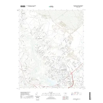
2019 Map of Jacksonville North
USGS Topo · Published 2019About this map
The New River corridor and its associated drainage networks define the residential and natural landscape north of Jacksonville. This 2019 survey captures the modern expansion of suburban Onslow County, where established neighborhoods like Bell Fork and Hawkside sit alongside significant wetland environments. To the north, the terrain transitions into the dense hydrology of the White Oak Pocosin and Bachelors Delight Swamp, while settlements like Half Moon and Gum Branch represent the area's rural-to-residential evolution. Researchers can examine the intricate road network extending from Gum Branch Rd and the Quartz Ln area, which navigates through a complex system of local tributaries including Half Moon Creek and Sandy Run Br. The map also details local landmarks such as Onslow Memorial Park and the waterfront access at Morgan Bay, illustrating how the coastal topography of the North Carolina tidewater continues to shape community development.
Find a feature on this map
241 named features on this map. Tap any name to fly to it.
Don’t see what you’re looking for? This feature index may not catch every label — zoom into the map to look around manually.
Map Details
Editions of this 2019 Jacksonville North Map
This is the sole edition of this map. No revisions or reprints were ever made.
Other maps of this area

1943 · Jacksonville
USGS Topo · 1:62,500

1948 · Maple Hill
USGS Topo · 1:62,500

1948 · New River
USGS Topo · 1:62,500

1948 · Richlands
USGS Topo · 1:62,500

1952 · Camp Lejeune
USGS Topo · 1:24,000

1952 · Jacksonville South
USGS Topo · 1:24,000

1953 · Beaufort
USGS Topo · 1:250,000

1954 · Beaufort
USGS Topo · 1:250,000

1965 · Richlands
USGS Topo · 1:62,500

1972 · Beaufort
USGS Topo · 1:250,000
Featured Places
- Jacksonville, NC
- Half Moon, NC
- Gum Branch, NC
- Hickory Hills West Trailer Park, NC
- Warrens Trailer Park, NC