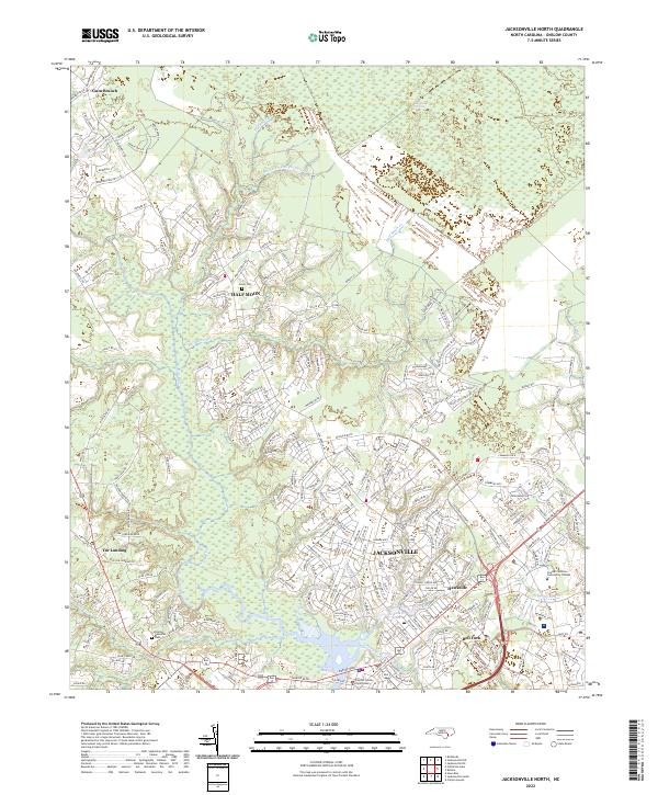
2022 Map of Jacksonville North
USGS Topo · Published 2022About this map
Jacksonville serves as the focal point of this coastal plain landscape, where urban development meets the dense wetlands of eastern North Carolina. The city's northern neighborhoods and the Onslow County Courthouse are bordered by a network of waterways including Chaney Cr and Morgan Bay. To the north, the terrain transitions into significant natural features such as the Bachglors Delight Swamp and the White Oak Pocosin, illustrating the challenge of building on such saturated ground. Small settlements like Half Moon and Gum Branch maintain a distinct presence alongside established institutional landmarks like Coastal Carolina Community College. Genealogists may find interest in the Greer Cem and Onslow Memorial Park, which anchor the local history of the Bell Fork and Tar Landing areas during this period of 21st-century growth.
Find a feature on this map
232 named features on this map. Tap any name to fly to it.
Don’t see what you’re looking for? This feature index may not catch every label — zoom into the map to look around manually.
Map Details
Editions of this 2022 Jacksonville North Map
This is the sole edition of this map. No revisions or reprints were ever made.
Other maps of this area

1943 · Jacksonville
USGS Topo · 1:62,500

1948 · Maple Hill
USGS Topo · 1:62,500

1948 · New River
USGS Topo · 1:62,500

1948 · Richlands
USGS Topo · 1:62,500

1952 · Camp Lejeune
USGS Topo · 1:24,000

1952 · Jacksonville South
USGS Topo · 1:24,000

1953 · Beaufort
USGS Topo · 1:250,000

1954 · Beaufort
USGS Topo · 1:250,000

1965 · Richlands
USGS Topo · 1:62,500

1972 · Beaufort
USGS Topo · 1:250,000
Featured Places
- Jacksonville, NC
- Half Moon, NC
- Gum Branch, NC
- Hickory Hills West Trailer Park, NC
- Warrens Trailer Park, NC